Title:
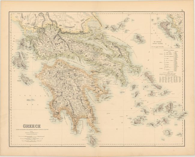
“Greece Chiefly According to the English Admiralty Surveys & Keipert”
Map Maker:
Archibald Fullarton [& Co.]
A highly detailed and densely engraved map of Gree... (full text available to subscribers)
| Item Detail |
| |
| |
MapMaker: |
Archibald Fullarton [& Co.]
|
|
| |
| |
Subject: |
Greece |
|
| |
Period/Size: |
1860 / 16.3" x 21.5" (41.4 x 54.7 cm)
|
|
| |
Color: |
Colored
|
|
| |
Condition: |
(A) Minor toning. (condition help) |
|
| |
Source: |
Royal Illustrated Atlas |
|
| |
References: |
|
|
| |
|
|
| Sales Information |
| |
| |
Price: |
|
|
| |
| |
Offered by: |
Old World Auctions |
|
| |
Catalog: |
Auction No. 175 - Antique Maps, Charts, Atlases & Globes (9482) |
|
| |
Lot/Item #: |
496 |
|
| |
| |
Date: |
11/2019
|
|
| |
| |
|
Antique Maps - Valuation and Pricing, Descriptions, Resources |
|
Home |
Information |
Search |
Register |
Contact Us |
Site Map
Americana Exchange, Inc. © 1999 - 2024 Americana Exchange, Inc.. All rights reserved.
OldMaps.com, the OldMaps.com logo and
AMPR are service marks or registered service marks of Americana Exchange, Inc..
|