Title:
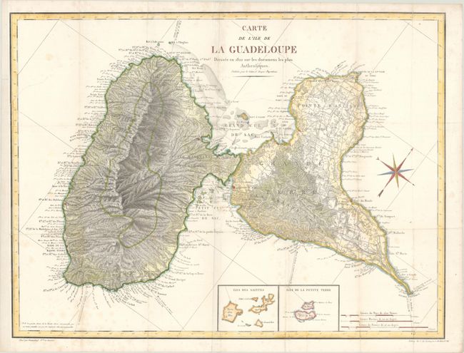
“Carte de l'Ile de la Guadeloupe Dressee en 1822 sur les Documens les Plus Authentiques”
Map Maker:
Infrequent Publ. - Local & State Maps
An uncommon map of this French island in the Lesse... (full text available to subscribers)
| Item Detail |
| |
| |
MapMaker: |
Infrequent Publ. - Local & State Maps
|
|
| |
| |
Subject: |
Guadeloupe |
|
| |
Period/Size: |
1823 / 18.1" x 24.0" (46.0 x 61.0 cm)
|
|
| |
Color: |
Colored
|
|
| |
Condition: |
(B+) Issued folding with light foxing and archival repairs to a 4" tear below the title and a 2.5" tear at left. The left margin has been extended to accommodate framing. (condition help) |
|
| |
Source: |
Les Antilles Francaises |
|
| |
References: |
|
|
| |
|
|
| Sales Information |
| |
| |
Price: |
|
|
| |
| |
Offered by: |
Old World Auctions |
|
| |
Catalog: |
Auction No. 175 - Antique Maps, Charts, Atlases & Globes (9482) |
|
| |
Lot/Item #: |
301 |
|
| |
| |
Date: |
11/2019
|
|
| |
| |
|
Antique Maps - Valuation and Pricing, Descriptions, Resources |
|
Home |
Information |
Search |
Register |
Contact Us |
Site Map
Americana Exchange, Inc. © 1999 - 2024 Americana Exchange, Inc.. All rights reserved.
OldMaps.com, the OldMaps.com logo and
AMPR are service marks or registered service marks of Americana Exchange, Inc..
|