| Item Detail |
| |
| |
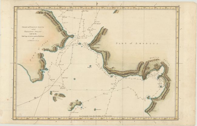
MapMaker: |
James Cook
|
|
| |
| |
Subject: |
North Pacific Ocean |
|
| |
Period/Size: |
1784 / 11.6" x 16.1" (29.5 x 40.9 cm)
|
|
| |
Color: |
Colored
|
|
| |
Condition: |
(A) A crisp impression, issued folding with a couple of unobtrusive spots and a few tiny fold separations along the edges of the sheet that have been archivally repaired. (condition help) |
|
| |
Source: |
A Voyage to the Pacific Ocean... |
|
| |
References: |
Shirley (BL Atlases) G.COOK-2a #14. |
|
| |
|
|
| Sales Information |
| |
| |
Price: |
|
|
| |
| |
Offered by: |
Old World Auctions |
|
| |
Catalog: |
Auction No. 175 - Antique Maps, Charts, Atlases & Globes (9482) |
|
| |
Lot/Item #: |
636 |
|
| |
| |
Date: |
11/2019
|
|
| |
| |
|