Title:
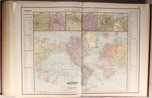
“Walker's International Atlas Containing Over One Hundred and Twenty New Maps, Showing the Geographical Location of Railroads, Cities, Towns, Post Offices, of Every State...”
Map Maker:
Henry B. Walker
This large atlas contains 52 singe-page and 78 dou... (full text available to subscribers)
| Item Detail |
| |
| |
MapMaker: |
Henry B. Walker
|
|
| |
| |
Subject: |
Atlases, World |
|
| |
Period/Size: |
1889 / 17.9" x 13.6" (45.5 x 34.6 cm)
|
|
| |
Color: |
Colored
|
|
| |
Condition: |
(A) The maps are clean, bright and near fine to fine with no tears or separations. Library stamps on title page, front pastedown, and a few other pages, with a withdrawn stamp on the pastedown. Covers are soiled with bumped edges. (condition help) |
|
| |
Source: |
|
|
| |
References: |
|
|
| |
|
|
| Sales Information |
| |
| |
Price: |
|
|
| |
| |
Offered by: |
Old World Auctions |
|
| |
Catalog: |
Auction No. 175 - Antique Maps, Charts, Atlases & Globes (9482) |
|
| |
Lot/Item #: |
684 |
|
| |
| |
Date: |
11/2019
|
|
| |
| |
|
Antique Maps - Valuation and Pricing, Descriptions, Resources |
|
Home |
Information |
Search |
Register |
Contact Us |
Site Map
Americana Exchange, Inc. © 1999 - 2024 Americana Exchange, Inc.. All rights reserved.
OldMaps.com, the OldMaps.com logo and
AMPR are service marks or registered service marks of Americana Exchange, Inc..
|