Title:
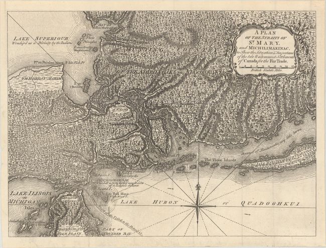
“A Plan of the Straits of St. Mary, and Michilimakinac, to Shew the Situation & Importance of the Two Westernmost Settlements of Canada for the Fur Trade”
Map Maker:
Anonymous
Uncommon map of the region where the fur trade flo... (full text available to subscribers)
| Item Detail |
| |
| |
MapMaker: |
Anonymous
|
|
| |
| |
Subject: |
Colonial Great Lakes |
|
| |
Period/Size: |
1761 / 9.4" x 12.8" (23.9 x 32.6 cm)
|
|
| |
Color: |
Black & White
|
|
| |
Condition: |
(A+) Issued folding on watermarked paper. (condition help) |
|
| |
Source: |
London Magazine |
|
| |
References: |
Jolly #LOND-197; Sellers and Van Ee #770. |
|
| |
|
|
| Sales Information |
| |
| |
Price: |
|
|
| |
| |
Offered by: |
Old World Auctions |
|
| |
Catalog: |
Auction No. 175 - Antique Maps, Charts, Atlases & Globes (9482) |
|
| |
Lot/Item #: |
103 |
|
| |
| |
Date: |
11/2019
|
|
| |
| |
|
Antique Maps - Valuation and Pricing, Descriptions, Resources |
|
Home |
Information |
Search |
Register |
Contact Us |
Site Map
Americana Exchange, Inc. © 1999 - 2024 Americana Exchange, Inc.. All rights reserved.
OldMaps.com, the OldMaps.com logo and
AMPR are service marks or registered service marks of Americana Exchange, Inc..
|