| Item Detail |
| |
| |
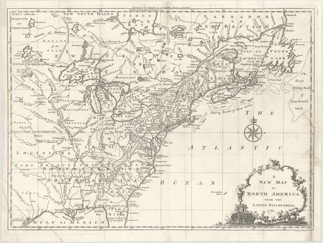
MapMaker: |
John Spilsbury
|
|
| |
| |
Subject: |
Colonial Eastern United States & Canada |
|
| |
Period/Size: |
1761 / 10.8" x 14.9" (27.5 x 37.9 cm)
|
|
| |
Color: |
Black & White
|
|
| |
Condition: |
(B+) On a bright sheet of watermarked paper, issued folding, with a binding trim at lower right that has been replaced with old paper. A 3.5" binding tear also at right has been repaired on verso with old paper. (condition help) |
|
| |
Source: |
The Continuation of Dr. Smollett's History of England |
|
| |
References: |
McCorkle #761.3; Sellers & Van Ee #89. |
|
| |
|
|
| Sales Information |
| |
| |
Price: |
|
|
| |
| |
Offered by: |
Old World Auctions |
|
| |
Catalog: |
Auction No. 175 - Antique Maps, Charts, Atlases & Globes (9482) |
|
| |
Lot/Item #: |
92 |
|
| |
| |
Date: |
11/2019
|
|
| |
| |
|