Title:
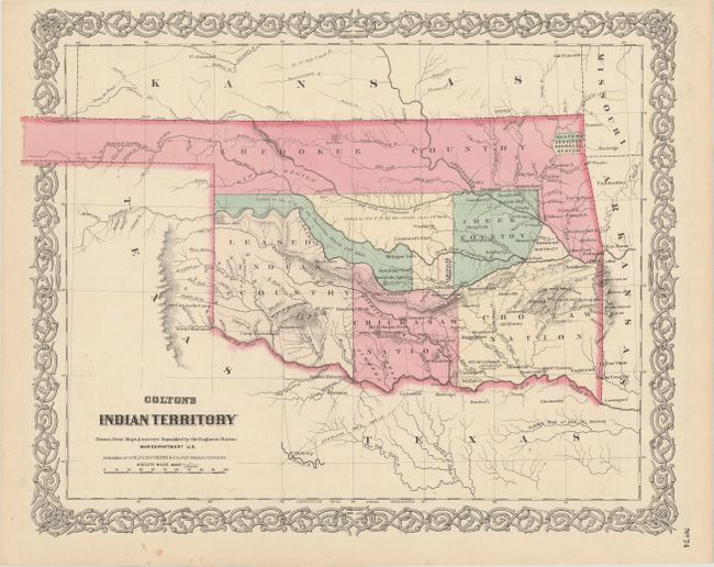
“Colton's Indian Territory Drawn from Maps & Surveys Furnished by the Engineer Bureau War Department U.S.”
Map Maker:
G.W. & C.B Colton [& Co.]
This is one of the earliest, if not the earliest, ... (full text available to subscribers)
| Item Detail |
| |
| |
MapMaker: |
G.W. & C.B Colton [& Co.]
|
|
| |
| |
Subject: |
Oklahoma |
|
| |
Period/Size: |
1869 / 12.9" x 16.0" (32.8 x 40.7 cm)
|
|
| |
Color: |
Colored
|
|
| |
Condition: |
(A) A few minor spots confined to the margins. (condition help) |
|
| |
Source: |
Colton's General Atlas |
|
| |
References: |
Rumsey #0152.060. |
|
| |
|
|
| Sales Information |
| |
| |
Price: |
|
|
| |
| |
Offered by: |
Old World Auctions |
|
| |
Catalog: |
Auction No. 175 - Antique Maps, Charts, Atlases & Globes (9482) |
|
| |
Lot/Item #: |
223 |
|
| |
| |
Date: |
11/2019
|
|
| |
| |
|
Antique Maps - Valuation and Pricing, Descriptions, Resources |
|
Home |
Information |
Search |
Register |
Contact Us |
Site Map
Americana Exchange, Inc. © 1999 - 2024 Americana Exchange, Inc.. All rights reserved.
OldMaps.com, the OldMaps.com logo and
AMPR are service marks or registered service marks of Americana Exchange, Inc..
|