Title:
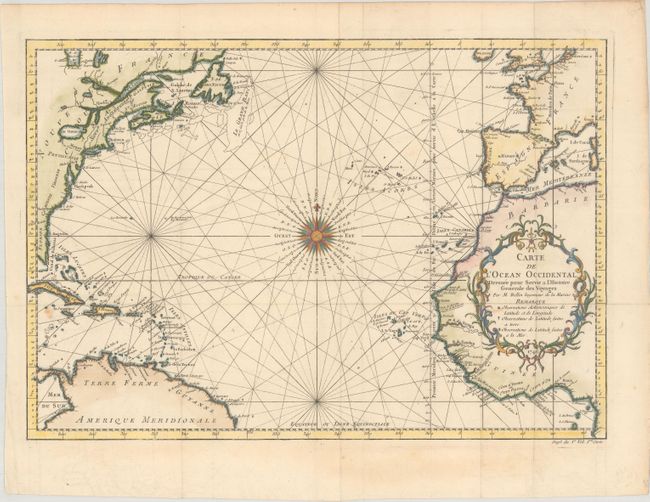
“Carte de l'Ocean Occidental Dressee pour Servir a l'Histoire Generale des Voyages...”
Map Maker:
Jacques Nicolas Bellin
This attractive chart of the North Atlantic is cen... (full text available to subscribers)
| Item Detail |
| |
| |
MapMaker: |
Jacques Nicolas Bellin
|
|
| |
| |
Subject: |
North Atlantic |
|
| |
Period/Size: |
1746 / 12.6" x 18.2" (32.0 x 46.3 cm)
|
|
| |
Color: |
Colored
|
|
| |
Condition: |
(A) Issued folding with a few faint spots, otherwise fine. (condition help) |
|
| |
Source: |
Prevost's Histoire Generale des Voyages |
|
| |
References: |
|
|
| |
|
|
| Sales Information |
| |
| |
Price: |
|
|
| |
| |
Offered by: |
Old World Auctions |
|
| |
Catalog: |
Auction No. 175 - Antique Maps, Charts, Atlases & Globes (9482) |
|
| |
Lot/Item #: |
344 |
|
| |
| |
Date: |
11/2019
|
|
| |
| |
|
Antique Maps - Valuation and Pricing, Descriptions, Resources |
|
Home |
Information |
Search |
Register |
Contact Us |
Site Map
Americana Exchange, Inc. © 1999 - 2024 Americana Exchange, Inc.. All rights reserved.
OldMaps.com, the OldMaps.com logo and
AMPR are service marks or registered service marks of Americana Exchange, Inc..
|