Title:
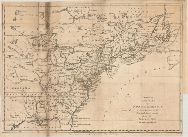
“A New and Correct Map of North America in Which the Places of the Principal Engagements During the Present War, Are Accurately Inserted”
Map Maker:
John Lodge
According to Jolly, this is an early state of the ... (full text available to subscribers)
| Item Detail |
| |
| |
MapMaker: |
John Lodge
|
|
| |
| |
Subject: |
Colonial Eastern United States & Canada |
|
| |
Period/Size: |
1780 / 10.8" x 15.1" (27.5 x 38.4 cm)
|
|
| |
Color: |
Black & White
|
|
| |
Condition: |
(B) Issued folding with light offsetting and heavy soiling along the left fold. Several fold separations along the left fold have been repaired on verso with old paper, with minor loss of image. There is a binding trim at lower right. (condition help) |
|
| |
Source: |
Political Magazine |
|
| |
References: |
Jolly #POL-5; Phillips (Maps) p. 590. |
|
| |
|
|
| Sales Information |
| |
| |
Price: |
|
|
| |
| |
Offered by: |
Old World Auctions |
|
| |
Catalog: |
Auction No. 175 - Antique Maps, Charts, Atlases & Globes (9482) |
|
| |
Lot/Item #: |
94 |
|
| |
| |
Date: |
11/2019
|
|
| |
| |
|
Antique Maps - Valuation and Pricing, Descriptions, Resources |
|
Home |
Information |
Search |
Register |
Contact Us |
Site Map
Americana Exchange, Inc. © 1999 - 2024 Americana Exchange, Inc.. All rights reserved.
OldMaps.com, the OldMaps.com logo and
AMPR are service marks or registered service marks of Americana Exchange, Inc..
|