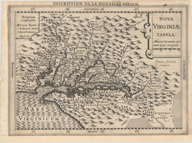
Title:
“Nova Virginiae Tabula”
Map Maker:
Mercator/Cloppenburgh
This delicately engraved map is a reduced version ... (full text available to subscribers)
| Item Detail |
| |
| |
MapMaker: |
Mercator/Cloppenburgh
|
|
| |
| |
Subject: |
Colonial Mid-Atlantic United States |
|
| |
Period/Size: |
1630 / 7.3" x 10.0" (18.6 x 25.4 cm)
|
|
| |
Color: |
Black & White
|
|
| |
Condition: |
(B+) A dark impression with a few faint spots. The sheet has been backed with tissue and remargined at bottom with a small portion of the border drawn in facsimile. (condition help) |
|
| |
Source: |
Gerardi Mercatoris Atlas sive Cosmographicae Meditationes... |
|
| |
References: |
Burden #226; Tooley (America) plt. 72; Van der Krogt (Vol. III) #9410:353. |
|
| |
|
|
| Sales Information |
| |
| |
Price: |
|
|
| |
| |
Offered by: |
Old World Auctions |
|
| |
Catalog: |
Auction No. 176 - Antique Maps, Charts, Atlases & Globes (9483) |
|
| |
Lot/Item #: |
134 |
|
| |
| |
Date: |
02/2020
|
|
| |
| |
|
Antique Maps - Valuation and Pricing, Descriptions, Resources |
|
Home |
Information |
Search |
Register |
Contact Us |
Site Map
Americana Exchange, Inc. © 1999 - 2024 Americana Exchange, Inc.. All rights reserved.
OldMaps.com, the OldMaps.com logo and
AMPR are service marks or registered service marks of Americana Exchange, Inc..
|