Title:
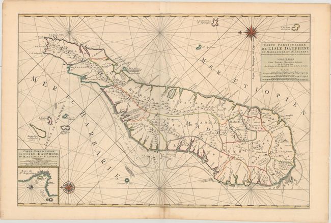
“Carte Particuliere de l'Isle Dauphine ou Madagascar et St. Laurens, Leve par Ordre Expres des Roys de Portugal sous qui on en a Fait la Decouverte”
Map Maker:
Jaillot/Mortier
This stunning sea chart depicts Madagascar with it... (full text available to subscribers)
| Item Detail |
| |
| |
MapMaker: |
Jaillot/Mortier
|
|
| |
| |
Subject: |
Madagascar |
|
| |
Period/Size: |
1700 / 22.3" x 33.4" (56.7 x 84.9 cm)
|
|
| |
Color: |
Colored
|
|
| |
Condition: |
(B+) A fine impression with light offsetting and some minor spots. (condition help) |
|
| |
Source: |
|
|
| |
References: |
Pastoureau, JAILLOT IF #356. |
|
| |
|
|
| Sales Information |
| |
| |
Price: |
|
|
| |
| |
Offered by: |
Old World Auctions |
|
| |
Catalog: |
Auction No. 176 - Antique Maps, Charts, Atlases & Globes (9483) |
|
| |
Lot/Item #: |
638 |
|
| |
| |
Date: |
02/2020
|
|
| |
| |
|
Antique Maps - Valuation and Pricing, Descriptions, Resources |
|
Home |
Information |
Search |
Register |
Contact Us |
Site Map
Americana Exchange, Inc. © 1999 - 2024 Americana Exchange, Inc.. All rights reserved.
OldMaps.com, the OldMaps.com logo and
AMPR are service marks or registered service marks of Americana Exchange, Inc..
|