Title:
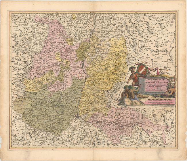
“Superioris Alsatiae nec non Brisigaviae et Suntgaviae Geographica Tabula, in qua Subjacentia Territoria Distincte Ostenduntur”
Map Maker:
Nicolas Visscher
This handsome map covers the Alsace region and the... (full text available to subscribers)
| Item Detail |
| |
| |
MapMaker: |
Nicolas Visscher
|
|
| |
| |
Subject: |
Western Europe, Rhine River |
|
| |
Period/Size: |
1680 / 18.2" x 22.3" (46.3 x 56.7 cm)
|
|
| |
Color: |
Colored
|
|
| |
Condition: |
(A) A dark impression in contemporary color with minor soiling mostly in the margins. There are small edge tears and chips in the blank margins, a few of which have been backed in old paper. (condition help) |
|
| |
Source: |
|
|
| |
References: |
|
|
| |
|
|
| Sales Information |
| |
| |
Price: |
|
|
| |
| |
Offered by: |
Old World Auctions |
|
| |
Catalog: |
Auction No. 176 - Antique Maps, Charts, Atlases & Globes (9483) |
|
| |
Lot/Item #: |
425 |
|
| |
| |
Date: |
02/2020
|
|
| |
| |
|
Antique Maps - Valuation and Pricing, Descriptions, Resources |
|
Home |
Information |
Search |
Register |
Contact Us |
Site Map
Americana Exchange, Inc. © 1999 - 2024 Americana Exchange, Inc.. All rights reserved.
OldMaps.com, the OldMaps.com logo and
AMPR are service marks or registered service marks of Americana Exchange, Inc..
|