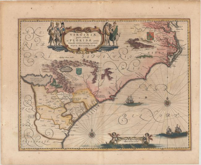
Title:
“Virginiae Partis Australis, et Floridae Partis Orientalis, Interjacentiumque Regionum Nova Descriptio”
Map Maker:
Jan Jansson
This lovely map of the Southeast extends from the ... (full text available to subscribers)
| Item Detail |
| |
| |
MapMaker: |
Jan Jansson
|
|
| |
| |
Subject: |
Colonial Southeast United States |
|
| |
Period/Size: |
1647 / 15.1" x 19.8" (38.4 x 50.3 cm)
|
|
| |
Color: |
Colored
|
|
| |
Condition: |
(B) Full contemporary color that has been partially refreshed with light foxing and offsetting. This map will ship flat - international customers please contact us for a shipping quote. (condition help) |
|
| |
Source: |
Atlas Novus |
|
| |
References: |
Burden #254; Cumming (SE) #42; Van der Krogt (Vol. I) #9400:1B. |
|
| |
|
|
| Sales Information |
| |
| |
Price: |
|
|
| |
| |
Offered by: |
Old World Auctions |
|
| |
Catalog: |
Auction No. 176 - Antique Maps, Charts, Atlases & Globes (9483) |
|
| |
Lot/Item #: |
145 |
|
| |
| |
Date: |
02/2020
|
|
| |
| |
|
Antique Maps - Valuation and Pricing, Descriptions, Resources |
|
Home |
Information |
Search |
Register |
Contact Us |
Site Map
Americana Exchange, Inc. © 1999 - 2024 Americana Exchange, Inc.. All rights reserved.
OldMaps.com, the OldMaps.com logo and
AMPR are service marks or registered service marks of Americana Exchange, Inc..
|