Title:
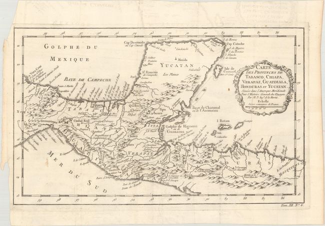
“Carte des Provinces de Tabasco, Chiapa. Verapaz, Guatimala, Honduras et Yucatan. Situees dans l'Amerique Meridionale pour l'Histoire Generale des Voyages”
Map Maker:
Jacques Nicolas Bellin
Nice detailed map of the Yucatan peninsula and nor... (full text available to subscribers)
| Item Detail |
| |
| |
MapMaker: |
Jacques Nicolas Bellin
|
|
| |
| |
Subject: |
Southern Mexico & Central America |
|
| |
Period/Size: |
1754 / 8.1" x 13.4" (20.6 x 34.1 cm)
|
|
| |
Color: |
Black & White
|
|
| |
Condition: |
(A) Issued folding, with a small rust stain adjacent to the title cartouche and minor offsetting that is mostly confined to the blank margins. (condition help) |
|
| |
Source: |
Histoire Generale des Voyages |
|
| |
References: |
Kapp (MCC-103) #45 plate X. |
|
| |
|
|
| Sales Information |
| |
| |
Price: |
|
|
| |
| |
Offered by: |
Old World Auctions |
|
| |
Catalog: |
Auction No. 176 - Antique Maps, Charts, Atlases & Globes (9483) |
|
| |
Lot/Item #: |
288 |
|
| |
| |
Date: |
02/2020
|
|
| |
| |
|
Antique Maps - Valuation and Pricing, Descriptions, Resources |
|
Home |
Information |
Search |
Register |
Contact Us |
Site Map
Americana Exchange, Inc. © 1999 - 2024 Americana Exchange, Inc.. All rights reserved.
OldMaps.com, the OldMaps.com logo and
AMPR are service marks or registered service marks of Americana Exchange, Inc..
|