| Item Detail |
| |
| |
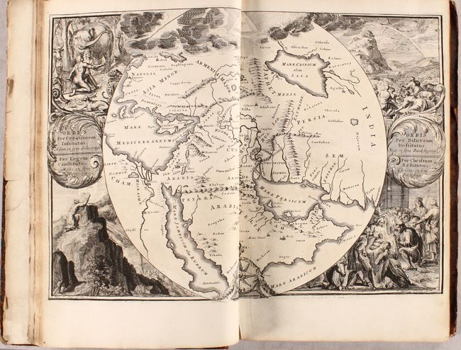
MapMaker: |
Romain de Hooghe
|
|
| |
| |
Subject: |
Holy Land, History Book |
|
| |
Period/Size: |
1714 / 16.4" x 10.8" (41.7 x 27.5 cm)
|
|
| |
Color: |
Black & White
|
|
| |
Condition: |
(B+) Maps are in very good to near fine condition with narrow side margins, as issued, light toning along the edges of the sheets, and a few short edge tears. The engravings are in excellent condition with occasional minor toning or soiling. Text has mi (condition help) |
|
| |
Source: |
|
|
| |
References: |
|
|
| |
|
|
| Sales Information |
| |
| |
Price: |
|
|
| |
| |
Offered by: |
Old World Auctions |
|
| |
Catalog: |
Auction No. 176 - Antique Maps, Charts, Atlases & Globes (9483) |
|
| |
Lot/Item #: |
580 |
|
| |
| |
Date: |
02/2020
|
|
| |
| |
|