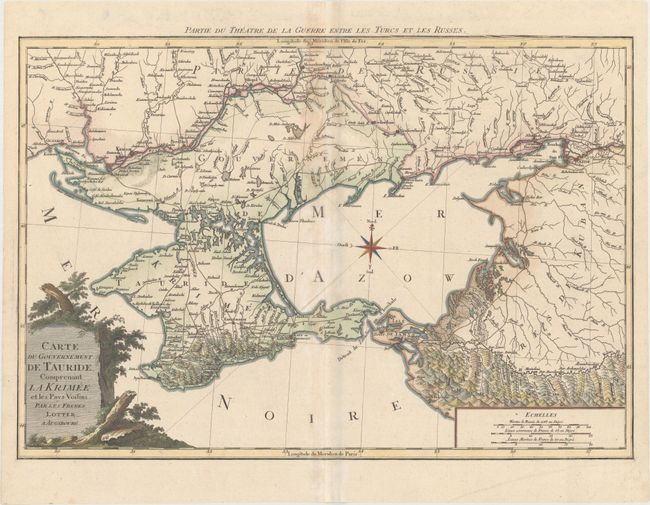
Title:
“Carte du Gouvernement de Tauride, Comprenant la Krimee et les Pays Voisins”
Map Maker:
Matthaus Albrecht Lotter
This rare map depicts the theater of war during th... (full text available to subscribers)
| Item Detail |
| |
| |
MapMaker: |
Matthaus Albrecht Lotter
|
|
| |
| |
Subject: |
Black Sea, Ukraine & Russia |
|
| |
Period/Size: |
1790 / 17.1" x 24.9" (43.5 x 63.3 cm)
|
|
| |
Color: |
Colored
|
|
| |
Condition: |
(B+) A nice impression on watermarked paper with light toning along centerfold and several printer's creases in border at top right. There is a grayish shadow adjacent to the centerfold that is caused by our scanner and doesn't appear on the map itself. (condition help) |
|
| |
Source: |
|
|
| |
References: |
|
|
| |
|
|
| Sales Information |
| |
| |
Price: |
|
|
| |
| |
Offered by: |
Old World Auctions |
|
| |
Catalog: |
Auction No. 176 - Antique Maps, Charts, Atlases & Globes (9483) |
|
| |
Lot/Item #: |
505 |
|
| |
| |
Date: |
02/2020
|
|
| |
| |
|
Antique Maps - Valuation and Pricing, Descriptions, Resources |
|
Home |
Information |
Search |
Register |
Contact Us |
Site Map
Americana Exchange, Inc. © 1999 - 2024 Americana Exchange, Inc.. All rights reserved.
OldMaps.com, the OldMaps.com logo and
AMPR are service marks or registered service marks of Americana Exchange, Inc..
|