| Item Detail |
| |
| |
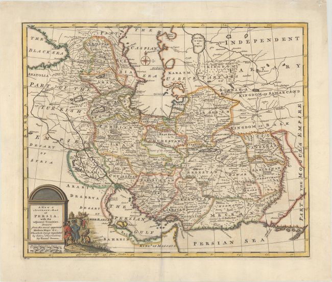
MapMaker: |
Emanuel Bowen
|
|
| |
| |
Subject: |
Persia - Iran |
|
| |
Period/Size: |
1747 / 13.6" x 16.6" (34.6 x 42.2 cm)
|
|
| |
Color: |
Colored
|
|
| |
Condition: |
(B+) Watermarked with a large fleur-de-lis coat of arms, with archivally repaired centerfold separations at top and bottom, a few faint stains, and a 1/2" tear just south of Maragheh (Maragha) that has been professionally repaired. (condition help) |
|
| |
Source: |
A Complete System of Geography... |
|
| |
References: |
McCorkle (18th c. Geography Books) #17-8 (Vol II); Shirley (BL Atlases) T.BOW-2a #39. |
|
| |
|
|
| Sales Information |
| |
| |
Price: |
|
|
| |
| |
Offered by: |
Old World Auctions |
|
| |
Catalog: |
Auction No. 176 - Antique Maps, Charts, Atlases & Globes (9483) |
|
| |
Lot/Item #: |
600 |
|
| |
| |
Date: |
02/2020
|
|
| |
| |
|