| Item Detail |
| |
| |
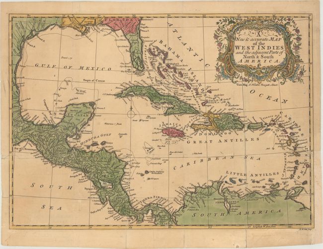
MapMaker: |
John Hinton
|
|
| |
| |
Subject: |
Gulf of Mexico & Caribbean |
|
| |
Period/Size: |
1755 / 10.4" x 14.7" (26.5 x 37.4 cm)
|
|
| |
Color: |
Colored
|
|
| |
Condition: |
(B) Issued folding, now flattened on paper with a Pro Patria watermark, full contemporary color in the map and later color in the cartouche. There is light toning and archival repairs to several fold separations and a binding tear that enters 2" into map (condition help) |
|
| |
Source: |
Universal Magazine |
|
| |
References: |
Jolly #UNIV-47; Seller & Van Ee #1686. |
|
| |
|
|
| Sales Information |
| |
| |
Price: |
|
|
| |
| |
Offered by: |
Old World Auctions |
|
| |
Catalog: |
Auction No. 176 - Antique Maps, Charts, Atlases & Globes (9483) |
|
| |
Lot/Item #: |
297 |
|
| |
| |
Date: |
02/2020
|
|
| |
| |
|