| Item Detail |
| |
| |
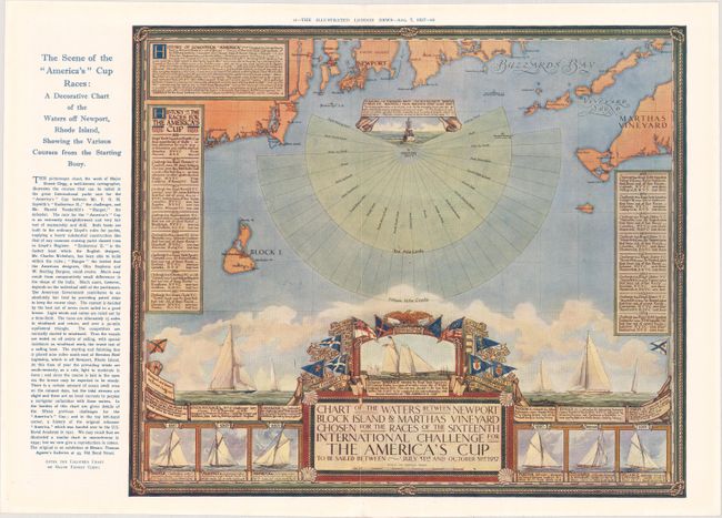
MapMaker: |
Ernest Clegg
|
|
| |
| |
Subject: |
New England - United States |
|
| |
Period/Size: |
1937 / 13.3" x 15.6" (33.8 x 39.7 cm)
|
|
| |
Color: |
Colored
|
|
| |
Condition: |
(A) Clean and bright with small binding holes along the centerfold, as issued. The image is slightly blurry at left due to a minor misalignment of the printed colors. (condition help) |
|
| |
Source: |
Illustrated London News |
|
| |
References: |
|
|
| |
|
|
| Sales Information |
| |
| |
Price: |
|
|
| |
| |
Offered by: |
Old World Auctions |
|
| |
Catalog: |
Auction No. 176 - Antique Maps, Charts, Atlases & Globes (9483) |
|
| |
Lot/Item #: |
132 |
|
| |
| |
Date: |
02/2020
|
|
| |
| |
|