Title:
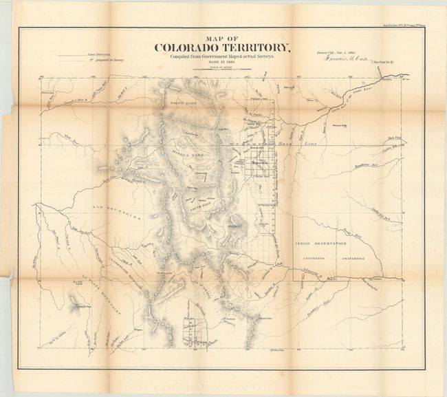
“Map of Colorado Territory, Compiled from Government Maps & Actual Survyes”
Map Maker:
U.S. State Surveys
This is the first official map of Colorado. It is... (full text available to subscribers)
| Item Detail |
| |
| |
MapMaker: |
U.S. State Surveys
|
|
| |
| |
Subject: |
Colorado |
|
| |
Period/Size: |
1861 / 17.7" x 20.9" (45.0 x 53.1 cm)
|
|
| |
Color: |
Black & White
|
|
| |
Condition: |
(B) Issued folding with minor foxing and light toning along the fold lines. There are a few short splits at the fold junctions and a 1.5" binding tear at left that has been closed on verso with archival tape. (condition help) |
|
| |
Source: |
Sen. Ex. Doc. No. 1 37th Congress, 2nd Session |
|
| |
References: |
Wheat (TMW) #1034. |
|
| |
|
|
| Sales Information |
| |
| |
Price: |
|
|
| |
| |
Offered by: |
Old World Auctions |
|
| |
Catalog: |
Auction No. 176 - Antique Maps, Charts, Atlases & Globes (9483) |
|
| |
Lot/Item #: |
195 |
|
| |
| |
Date: |
02/2020
|
|
| |
| |
|
Antique Maps - Valuation and Pricing, Descriptions, Resources |
|
Home |
Information |
Search |
Register |
Contact Us |
Site Map
Americana Exchange, Inc. © 1999 - 2024 Americana Exchange, Inc.. All rights reserved.
OldMaps.com, the OldMaps.com logo and
AMPR are service marks or registered service marks of Americana Exchange, Inc..
|