Title:
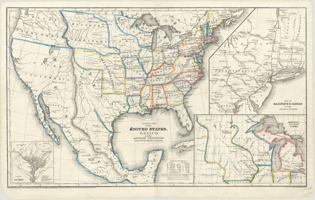
“Political Map of the United States, Mexico and the British Provinces Adapted to Woodbridges Geography”
Map Maker:
William Channing Woodbridge
This fascinating map of the United States and Mexi... (full text available to subscribers)
| Item Detail |
| |
| |
MapMaker: |
William Channing Woodbridge
|
|
| |
| |
Subject: |
United States & Mexico |
|
| |
Period/Size: |
1845 / 10.8" x 18.0" (27.5 x 45.8 cm)
|
|
| |
Color: |
Colored
|
|
| |
Condition: |
(B+) A 7.5" tear at left has been expertly repaired on verso. Short centerfold separations at top and bottom have been closed on verso with archival materials. (condition help) |
|
| |
Source: |
Modern Atlas, Physical, Political and Statistical... |
|
| |
References: |
Rumsey #1229.012. |
|
| |
|
|
| Sales Information |
| |
| |
Price: |
|
|
| |
| |
Offered by: |
Old World Auctions |
|
| |
Catalog: |
Auction No. 176 - Antique Maps, Charts, Atlases & Globes (9483) |
|
| |
Lot/Item #: |
266 |
|
| |
| |
Date: |
02/2020
|
|
| |
| |
|
Antique Maps - Valuation and Pricing, Descriptions, Resources |
|
Home |
Information |
Search |
Register |
Contact Us |
Site Map
Americana Exchange, Inc. © 1999 - 2024 Americana Exchange, Inc.. All rights reserved.
OldMaps.com, the OldMaps.com logo and
AMPR are service marks or registered service marks of Americana Exchange, Inc..
|