Title:
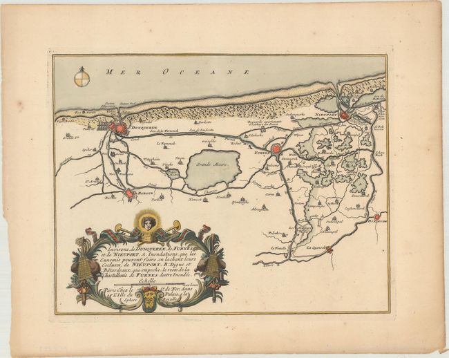
“Environs, de Dunquerke, de Furnes et de Nieuport, A. Inondations, que les Ennemis Peuvent Faire, en Lachant Leurs Escluses, de Nieuport, B. Digue et Batardeaux...”
Map Maker:
Nicolas de Fer
This fine chart displays the vicinity of Dunkirk a... (full text available to subscribers)
| Item Detail |
| |
| |
MapMaker: |
Nicolas de Fer
|
|
| |
| |
Subject: |
France-Belgium Border |
|
| |
Period/Size: |
1695 / 8.4" x 10.9" (21.4 x 27.7 cm)
|
|
| |
Color: |
Colored
|
|
| |
Condition: |
(A) A fine impression on watermarked paper with a few very minor spots and marginal toning. (condition help) |
|
| |
Source: |
Les Forces de l'Europe |
|
| |
References: |
Pastoureau, FER IX B #60. |
|
| |
|
|
| Sales Information |
| |
| |
Price: |
|
|
| |
| |
Offered by: |
Old World Auctions |
|
| |
Catalog: |
Auction No. 176 - Antique Maps, Charts, Atlases & Globes (9483) |
|
| |
Lot/Item #: |
430 |
|
| |
| |
Date: |
02/2020
|
|
| |
| |
|
Antique Maps - Valuation and Pricing, Descriptions, Resources |
|
Home |
Information |
Search |
Register |
Contact Us |
Site Map
Americana Exchange, Inc. © 1999 - 2024 Americana Exchange, Inc.. All rights reserved.
OldMaps.com, the OldMaps.com logo and
AMPR are service marks or registered service marks of Americana Exchange, Inc..
|