Title:
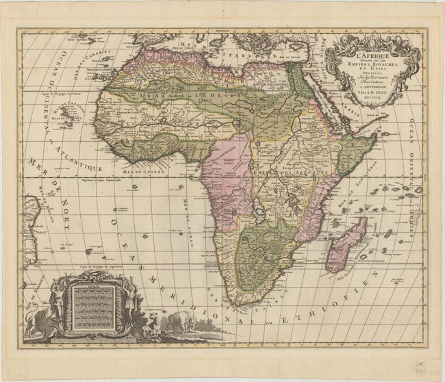
“L'Afrique Divisee en Ses Empires, Royaumes, et Etats, Dressees sur les Dernieres Observations”
Map Maker:
Jan Barend Elwe
This handsome, large map of Africa was copied from... (full text available to subscribers)
| Item Detail |
| |
| |
MapMaker: |
Jan Barend Elwe
|
|
| |
| |
Subject: |
Africa |
|
| |
Period/Size: |
1792 / 18.0" x 23.2" (45.8 x 59.0 cm)
|
|
| |
Color: |
Colored
|
|
| |
Condition: |
(A) Contemporary color on paper with two elephant watermarks with some minor spots of color offsetting. Faint toning in the blank margins. (condition help) |
|
| |
Source: |
|
|
| |
References: |
Norwich #109. |
|
| |
|
|
| Sales Information |
| |
| |
Price: |
|
|
| |
| |
Offered by: |
Old World Auctions |
|
| |
Catalog: |
Auction No. 176 - Antique Maps, Charts, Atlases & Globes (9483) |
|
| |
Lot/Item #: |
650 |
|
| |
| |
Date: |
02/2020
|
|
| |
| |
|
Antique Maps - Valuation and Pricing, Descriptions, Resources |
|
Home |
Information |
Search |
Register |
Contact Us |
Site Map
Americana Exchange, Inc. © 1999 - 2024 Americana Exchange, Inc.. All rights reserved.
OldMaps.com, the OldMaps.com logo and
AMPR are service marks or registered service marks of Americana Exchange, Inc..
|