| Item Detail |
| |
| |
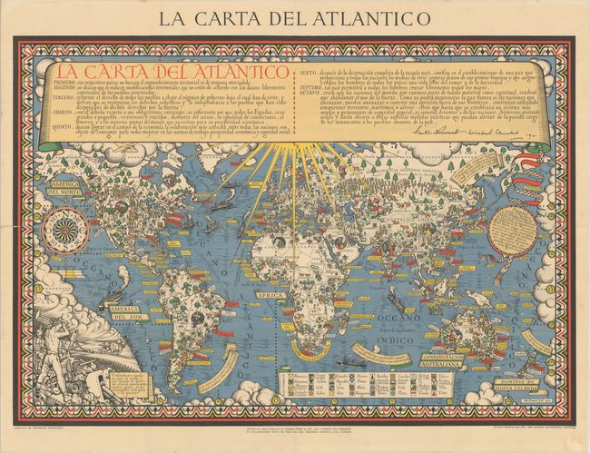
MapMaker: |
George Philip [& Son]
|
|
| |
| |
Subject: |
World, World War II |
|
| |
Period/Size: |
1943 / 29.8" x 43.1" (75.7 x 109.5 cm)
|
|
| |
Color: |
Colored
|
|
| |
Condition: |
(B+) A clean and bright example, issued folding, with tiny splits and holes at fold intersections with minor loss of image, and a 12" split along a fold at left that has been closed on verso with archival tape. There is a bit of old adhesive residue conf (condition help) |
|
| |
Source: |
|
|
| |
References: |
Curtis & Pedersen (War Map) pp. 160-63; Hornsby (Picturing America) pp. 226-27; PJ Mode #2015; Rumsey #7864. |
|
| |
|
|
| Sales Information |
| |
| |
Price: |
|
|
| |
| |
Offered by: |
Old World Auctions |
|
| |
Catalog: |
Auction No. 176 - Antique Maps, Charts, Atlases & Globes (9483) |
|
| |
Lot/Item #: |
17 |
|
| |
| |
Date: |
02/2020
|
|
| |
| |
|