| Item Detail |
| |
| |
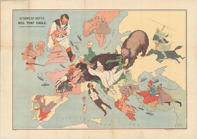
MapMaker: |
Geographia Map Co.
|
|
| |
| |
Subject: |
Europe, World War I |
|
| |
Period/Size: |
1914 / 19.3" x 28.3" (49.1 x 71.9 cm)
|
|
| |
Color: |
Colored
|
|
| |
Condition: |
(B+) A bright example with very light soiling, issued folding and now flattened with the folds professionally reinforced with archival tissue to repair small holes at fold intersections. The map is still attached to the paper wrappers, which are moderate (condition help) |
|
| |
Source: |
|
|
| |
References: |
Curtis & Pedersen (War Map) pp. 30-31. |
|
| |
|
|
| Sales Information |
| |
| |
Price: |
|
|
| |
| |
Offered by: |
Old World Auctions |
|
| |
Catalog: |
Auction No. 176 - Antique Maps, Charts, Atlases & Globes (9483) |
|
| |
Lot/Item #: |
370 |
|
| |
| |
Date: |
02/2020
|
|
| |
| |
|