| Item Detail |
| |
| |
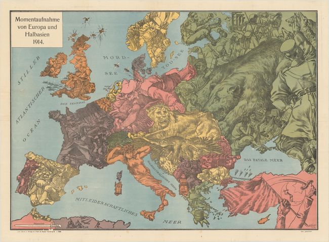
MapMaker: |
Graht & Kaspar
|
|
| |
| |
Subject: |
Europe, World War I |
|
| |
Period/Size: |
1914 / 19.0" x 26.6" (48.3 x 67.6 cm)
|
|
| |
Color: |
Colored
|
|
| |
Condition: |
(A) A bright example, issued folding and now flattened with the folds professionally reinforced with thin, archival tissue to repair a few minor separations. A 2" tear at left has also been professionally repaired. (condition help) |
|
| |
Source: |
|
|
| |
References: |
|
|
| |
|
|
| Sales Information |
| |
| |
Price: |
|
|
| |
| |
Offered by: |
Old World Auctions |
|
| |
Catalog: |
Auction No. 176 - Antique Maps, Charts, Atlases & Globes (9483) |
|
| |
Lot/Item #: |
371 |
|
| |
| |
Date: |
02/2020
|
|
| |
| |
|