Title:
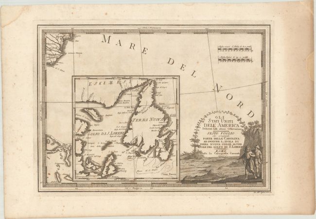
“Gli Stati Uniti dell'America Delineati Sulle Ultime Osservazioni - Sesto Foglio che Comprende Parte Della Carolina ed Inoltre l'Isola di Terra Nuova Colle Altre Isole del Golfo di S. Lorenzo”
Map Maker:
Giovanni Maria Cassini
A very large inset is the primary focus of this de... (full text available to subscribers)
| Item Detail |
| |
| |
MapMaker: |
Giovanni Maria Cassini
|
|
| |
| |
Subject: |
Eastern Canada & Southeast United States |
|
| |
Period/Size: |
1797 / 13.5" x 18.7" (34.3 x 47.5 cm)
|
|
| |
Color: |
Black & White
|
|
| |
Condition: |
(B+) A dark impression on watermarked paper with scattered foxing and a bit of uneven toning. (condition help) |
|
| |
Source: |
Nuovo Atlante Geografico Universale |
|
| |
References: |
Kershaw #617. |
|
| |
|
|
| Sales Information |
| |
| |
Price: |
|
|
| |
| |
Offered by: |
Old World Auctions |
|
| |
Catalog: |
Auction No. 176 - Antique Maps, Charts, Atlases & Globes (9483) |
|
| |
Lot/Item #: |
98 |
|
| |
| |
Date: |
02/2020
|
|
| |
| |
|
Antique Maps - Valuation and Pricing, Descriptions, Resources |
|
Home |
Information |
Search |
Register |
Contact Us |
Site Map
Americana Exchange, Inc. © 1999 - 2024 Americana Exchange, Inc.. All rights reserved.
OldMaps.com, the OldMaps.com logo and
AMPR are service marks or registered service marks of Americana Exchange, Inc..
|