| Item Detail |
| |
| |
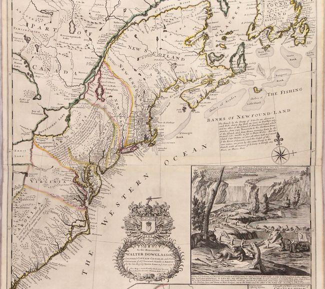
MapMaker: |
Herman Moll
|
|
| |
| |
Subject: |
Colonial Eastern United States & Canada |
|
| |
Period/Size: |
1715 / 39.9" x 24.1" (101.4 x 61.3 cm)
|
|
| |
Color: |
Colored
|
|
| |
Condition: |
(A) A beautiful example with dark impression and contemporary outline color. There is some very minor creasing adjacent to St. George's Bank and one tiny hole caused by a paper flaw in the rocky area of the Beaver inset only visible when held to light. (condition help) |
|
| |
Source: |
The World Described, or a New and Correct Sett of Maps... |
|
| |
References: |
McCorkle #715.1; Stevens & Tree #55c; Pritchard & Taliaferro #19; Cumming (SE) #158; Schwartz & Ehrenberg, plt. 78; Shirley (BL Atlases) T.MOLL-4c #10. |
|
| |
|
|
| Sales Information |
| |
| |
Price: |
|
|
| |
| |
Offered by: |
Old World Auctions |
|
| |
Catalog: |
Auction No. 176 - Antique Maps, Charts, Atlases & Globes (9483) |
|
| |
Lot/Item #: |
90 |
|
| |
| |
Date: |
02/2020
|
|
| |
| |
|