| Item Detail |
| |
| |
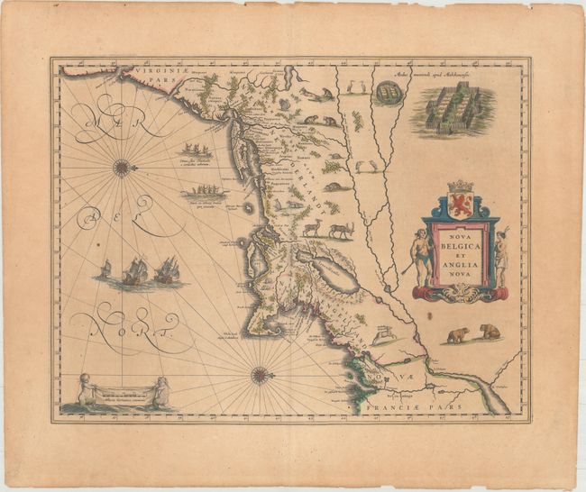
MapMaker: |
Willem Blaeu
|
|
| |
| |
Subject: |
Colonial New England & Mid-Atlantic United States |
|
| |
Period/Size: |
1643 / 15.1" x 19.8" (38.4 x 50.3 cm)
|
|
| |
Color: |
Colored
|
|
| |
Condition: |
(B) Contemporary color on watermarked paper with wide margins, light toning, a printer's crease to the right of the ships, several small spots, and some tiny chips along the edges of the sheet. (condition help) |
|
| |
Source: |
Theatre du Monde ou Nouvel Atlas |
|
| |
References: |
Burden #241; Goss (Blaeu) p. 164; McCorkle #635.1; Van der Krogt (Vol. II) #9310:2. |
|
| |
|
|
| Sales Information |
| |
| |
Price: |
|
|
| |
| |
Offered by: |
Old World Auctions |
|
| |
Catalog: |
Auction No. 174 - Antique Maps, Charts, Atlases & Globes (9472) |
|
| |
Lot/Item #: |
139 |
|
| |
| |
Date: |
09/2019
|
|
| |
| |
|