Title:
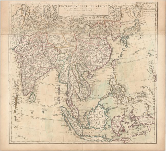
“Carte des Indes et de la Chine Dressee sur Plusieurs Relations Particulieres Rectifiees par Quelques Observations”
Map Maker:
Guillaume Delisle
This large, attractive map covers the vast region ... (full text available to subscribers)
| Item Detail |
| |
| |
MapMaker: |
Guillaume Delisle
|
|
| |
| |
Subject: |
Eastern, Southern & Southeast Asia |
|
| |
Period/Size: |
1700 / 24.8" x 25.9" (63.0 x 65.8 cm)
|
|
| |
Color: |
Colored
|
|
| |
Condition: |
(B+) Contemporary outline and wash color on watermarked paper with light foxing and toning. There is a professionally repaired centerfold separation at bottom. (condition help) |
|
| |
Source: |
|
|
| |
References: |
|
|
| |
|
|
| Sales Information |
| |
| |
Price: |
|
|
| |
| |
Offered by: |
Old World Auctions |
|
| |
Catalog: |
Auction No. 174 - Antique Maps, Charts, Atlases & Globes (9472) |
|
| |
Lot/Item #: |
698 |
|
| |
| |
Date: |
09/2019
|
|
| |
| |
|
Antique Maps - Valuation and Pricing, Descriptions, Resources |
|
Home |
Information |
Search |
Register |
Contact Us |
Site Map
Americana Exchange, Inc. © 1999 - 2024 Americana Exchange, Inc.. All rights reserved.
OldMaps.com, the OldMaps.com logo and
AMPR are service marks or registered service marks of Americana Exchange, Inc..
|