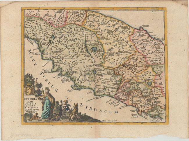
Title:
“Etruriae Latii Umbriae Piceni Sabinorum et Marsorum Vetus et Nova Descriptio”
Map Maker:
Philipp Cluver
This is an attractive map of central Italy, from T... (full text available to subscribers)
| Item Detail |
| |
| |
MapMaker: |
Philipp Cluver
|
|
| |
| |
Subject: |
Central Italy |
|
| |
Period/Size: |
1711 / 7.9" x 9.9" (20.1 x 25.2 cm)
|
|
| |
Color: |
Colored
|
|
| |
Condition: |
(B+) A crisp impression with minor toning along the centerfold. (condition help) |
|
| |
Source: |
Introductio in Universam Geographiam |
|
| |
References: |
Shirley (BL Atlases) T.CLUV-9a #19. |
|
| |
|
|
| Sales Information |
| |
| |
Price: |
|
|
| |
| |
Offered by: |
Old World Auctions |
|
| |
Catalog: |
Auction No. 174 - Antique Maps, Charts, Atlases & Globes (9472) |
|
| |
Lot/Item #: |
602 |
|
| |
| |
Date: |
09/2019
|
|
| |
| |
|
Antique Maps - Valuation and Pricing, Descriptions, Resources |
|
Home |
Information |
Search |
Register |
Contact Us |
Site Map
Americana Exchange, Inc. © 1999 - 2024 Americana Exchange, Inc.. All rights reserved.
OldMaps.com, the OldMaps.com logo and
AMPR are service marks or registered service marks of Americana Exchange, Inc..
|