Title:
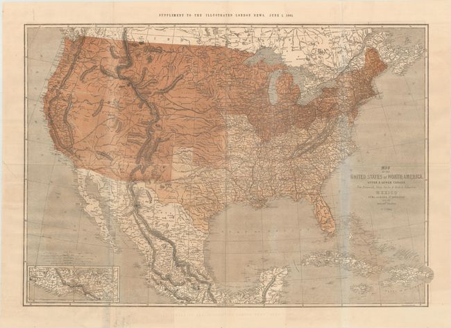
“Map of the United States of North America, Upper & Lower Canada New Brunswick, Nova Scotia & British Columbia Mexico Cuba, Jamaica, St. Domingo and the Bahama Islands”
Map Maker:
Theodor Ettling
This interesting map shows the Union and Confedera... (full text available to subscribers)
| Item Detail |
| |
| |
MapMaker: |
Theodor Ettling
|
|
| |
| |
Subject: |
United States & Mexico |
|
| |
Period/Size: |
1861 / 25.8" x 37.1" (65.6 x 94.3 cm)
|
|
| |
Color: |
Colored
|
|
| |
Condition: |
(B+) Issued folding with light color offsetting. There is a thin strip of image in the inset at bottom left that has been reattached with archival material on verso. (condition help) |
|
| |
Source: |
The Illustrated London News |
|
| |
References: |
Wheat (TMW) #1025. |
|
| |
|
|
| Sales Information |
| |
| |
Price: |
|
|
| |
| |
Offered by: |
Old World Auctions |
|
| |
Catalog: |
Auction No. 174 - Antique Maps, Charts, Atlases & Globes (9472) |
|
| |
Lot/Item #: |
264 |
|
| |
| |
Date: |
09/2019
|
|
| |
| |
|
Antique Maps - Valuation and Pricing, Descriptions, Resources |
|
Home |
Information |
Search |
Register |
Contact Us |
Site Map
Americana Exchange, Inc. © 1999 - 2024 Americana Exchange, Inc.. All rights reserved.
OldMaps.com, the OldMaps.com logo and
AMPR are service marks or registered service marks of Americana Exchange, Inc..
|