Title:
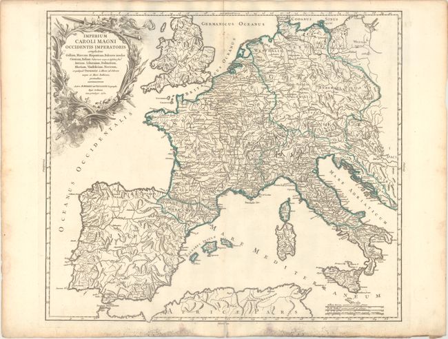
“Imperium Caroli Magni Occidentis Imperatoris Complectens Galliam, Marcam Hispanicam, Baleares Insulas Corsicam, Italiam...”
Map Maker:
Didier Robert de Vaugondy
This is the first state of this attractive and det... (full text available to subscribers)
| Item Detail |
| |
| |
MapMaker: |
Didier Robert de Vaugondy
|
|
| |
| |
Subject: |
Western Europe |
|
| |
Period/Size: |
1752 / 18.8" x 21.6" (47.8 x 54.9 cm)
|
|
| |
Color: |
Colored
|
|
| |
Condition: |
(B+) A dark impression on a bright sheet with a Society of Jesuits watermark and a short centerfold separation in the bottom blank margin. There is minor soiling and a few mildew spots around the centerfold at top and in the bottom blank margin. (condition help) |
|
| |
Source: |
Atlas Universel |
|
| |
References: |
Pedley #93 and pp. 54-60. |
|
| |
|
|
| Sales Information |
| |
| |
Price: |
|
|
| |
| |
Offered by: |
Old World Auctions |
|
| |
Catalog: |
Auction No. 174 - Antique Maps, Charts, Atlases & Globes (9472) |
|
| |
Lot/Item #: |
455 |
|
| |
| |
Date: |
09/2019
|
|
| |
| |
|
Antique Maps - Valuation and Pricing, Descriptions, Resources |
|
Home |
Information |
Search |
Register |
Contact Us |
Site Map
Americana Exchange, Inc. © 1999 - 2024 Americana Exchange, Inc.. All rights reserved.
OldMaps.com, the OldMaps.com logo and
AMPR are service marks or registered service marks of Americana Exchange, Inc..
|