Title:
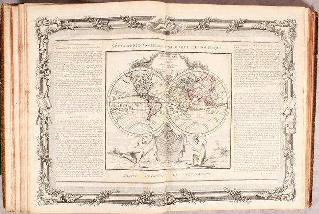
“Atlas General Methodique et Elementaire, pour l'Etude de la Geographie et de l'Histoire Moderne...”
Map Maker:
Louis Charles Desnos
This complete French atlas contains 59 double-page... (full text available to subscribers)
| Item Detail |
| |
| |
MapMaker: |
Louis Charles Desnos
|
|
| |
| |
Subject: |
Atlases, World |
|
| |
Period/Size: |
1770 / 16.8" x 12.8" (42.7 x 32.6 cm)
|
|
| |
Color: |
Colored
|
|
| |
Condition: |
(B+) The maps are very good with some light toning (mostly in the text panels) and occasional offsetting. The first map of France has some soiling and chips in the bottom blank margin. The spine has been rebacked with the original spine label and boards (condition help) |
|
| |
Source: |
|
|
| |
References: |
|
|
| |
|
|
| Sales Information |
| |
| |
Price: |
|
|
| |
| |
Offered by: |
Old World Auctions |
|
| |
Catalog: |
Auction No. 174 - Antique Maps, Charts, Atlases & Globes (9472) |
|
| |
Lot/Item #: |
791 |
|
| |
| |
Date: |
09/2019
|
|
| |
| |
|
Antique Maps - Valuation and Pricing, Descriptions, Resources |
|
Home |
Information |
Search |
Register |
Contact Us |
Site Map
Americana Exchange, Inc. © 1999 - 2024 Americana Exchange, Inc.. All rights reserved.
OldMaps.com, the OldMaps.com logo and
AMPR are service marks or registered service marks of Americana Exchange, Inc..
|