Title:
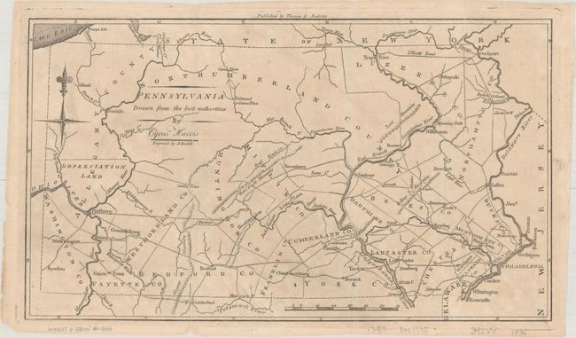
“Pennsylvania Drawn from the Best Authorities by Cyrus Harris”
Map Maker:
Jedidiah Morse
This early American map of the state of Pennsylvan... (full text available to subscribers)
| Item Detail |
| |
| |
MapMaker: |
Jedidiah Morse
|
|
| |
| |
Subject: |
Pennsylvania |
|
| |
Period/Size: |
1796 / 7.6" x 13.2" (19.3 x 33.6 cm)
|
|
| |
Color: |
Black & White
|
|
| |
Condition: |
(B+) Issued folding with minor toning and offsetting. There are several small fold separations that have been closed on verso with both archival and hinge tape. (condition help) |
|
| |
Source: |
The American Universal Geography |
|
| |
References: |
McCorkle (18th C. Geography Books) #304-9; Wheat & Brun #446; Maps (Phillips) p. 697. |
|
| |
|
|
| Sales Information |
| |
| |
Price: |
|
|
| |
| |
Offered by: |
Old World Auctions |
|
| |
Catalog: |
Auction No. 174 - Antique Maps, Charts, Atlases & Globes (9472) |
|
| |
Lot/Item #: |
247 |
|
| |
| |
Date: |
09/2019
|
|
| |
| |
|
Antique Maps - Valuation and Pricing, Descriptions, Resources |
|
Home |
Information |
Search |
Register |
Contact Us |
Site Map
Americana Exchange, Inc. © 1999 - 2024 Americana Exchange, Inc.. All rights reserved.
OldMaps.com, the OldMaps.com logo and
AMPR are service marks or registered service marks of Americana Exchange, Inc..
|