Title:
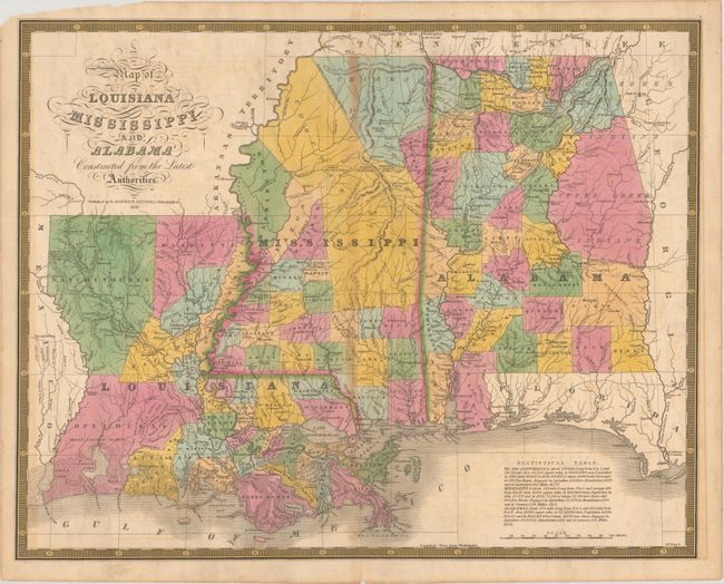
“Map of Louisiana Mississippi and Alabama Constructed from the Latest Authorities”
Map Maker:
Samuel Augustus Mitchell
This map of Louisiana, Mississippi, and Alabama is... (full text available to subscribers)
| Item Detail |
| |
| |
MapMaker: |
Samuel Augustus Mitchell
|
|
| |
| |
Subject: |
Southern United States |
|
| |
Period/Size: |
1831 / 16.9" x 21.4" (43.0 x 54.4 cm)
|
|
| |
Color: |
Colored
|
|
| |
Condition: |
(B+) Original color with faint offsetting and light toning along the centerfold. Centerfold separations at top and bottom have been closed on verso with archival tape. The top left corner of the blank margin is chipped, but still adequate for framing. (condition help) |
|
| |
Source: |
A New American Atlas |
|
| |
References: |
Ristow, p. 303-304 |
|
| |
|
|
| Sales Information |
| |
| |
Price: |
|
|
| |
| |
Offered by: |
Old World Auctions |
|
| |
Catalog: |
Auction No. 174 - Antique Maps, Charts, Atlases & Globes (9472) |
|
| |
Lot/Item #: |
165 |
|
| |
| |
Date: |
09/2019
|
|
| |
| |
|
Antique Maps - Valuation and Pricing, Descriptions, Resources |
|
Home |
Information |
Search |
Register |
Contact Us |
Site Map
Americana Exchange, Inc. © 1999 - 2024 Americana Exchange, Inc.. All rights reserved.
OldMaps.com, the OldMaps.com logo and
AMPR are service marks or registered service marks of Americana Exchange, Inc..
|