Title:
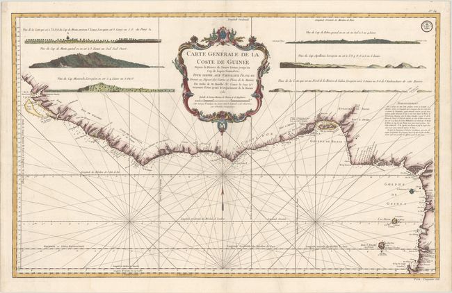
“Carte Generale de la Coste de Guinee Depuis la Riviere de Sierra Leona Jusqu'au Cap de Lopes Gonsalvo...”
Map Maker:
Jacques Nicolas Bellin
Striking sea chart of the western coast of Africa ... (full text available to subscribers)
| Item Detail |
| |
| |
MapMaker: |
Jacques Nicolas Bellin
|
|
| |
| |
Subject: |
Western Africa |
|
| |
Period/Size: |
1750 / 21.7" x 34.9" (55.2 x 88.7 cm)
|
|
| |
Color: |
Colored
|
|
| |
Condition: |
(A) There is a diagonal printer's crease in map, else near fine. (condition help) |
|
| |
Source: |
L'Hydrographie Francoise |
|
| |
References: |
Phillips (Atlases) #587. |
|
| |
|
|
| Sales Information |
| |
| |
Price: |
|
|
| |
| |
Offered by: |
Old World Auctions |
|
| |
Catalog: |
Auction No. 174 - Antique Maps, Charts, Atlases & Globes (9472) |
|
| |
Lot/Item #: |
760 |
|
| |
| |
Date: |
09/2019
|
|
| |
| |
|
Antique Maps - Valuation and Pricing, Descriptions, Resources |
|
Home |
Information |
Search |
Register |
Contact Us |
Site Map
Americana Exchange, Inc. © 1999 - 2024 Americana Exchange, Inc.. All rights reserved.
OldMaps.com, the OldMaps.com logo and
AMPR are service marks or registered service marks of Americana Exchange, Inc..
|