Title:
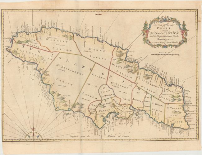
“A New & Correct Chart, of the Island of Jamaica. With Its Bays, Harbours, Rocks, Soundings &c.”
Map Maker:
Mount & Page
This finely engraved map of Jamaica is primarily f... (full text available to subscribers)
| Item Detail |
| |
| |
MapMaker: |
Mount & Page
|
|
| |
| |
Subject: |
Jamaica |
|
| |
Period/Size: |
1773 / 17.9" x 26.8" (45.5 x 68.1 cm)
|
|
| |
Color: |
Colored
|
|
| |
Condition: |
(B+) Light toning and offsetting with a few fold separations and a tiny tear in blank area of map image that have been closed on verso with Japanese tissue. (condition help) |
|
| |
Source: |
The English Pilot. The Fourth Book |
|
| |
References: |
Sellers & Van Ee #1922; Shirley (BL Atlases) M.M&P-5h #17. |
|
| |
|
|
| Sales Information |
| |
| |
Price: |
|
|
| |
| |
Offered by: |
Old World Auctions |
|
| |
Catalog: |
Auction No. 174 - Antique Maps, Charts, Atlases & Globes (9472) |
|
| |
Lot/Item #: |
309 |
|
| |
| |
Date: |
09/2019
|
|
| |
| |
|
Antique Maps - Valuation and Pricing, Descriptions, Resources |
|
Home |
Information |
Search |
Register |
Contact Us |
Site Map
Americana Exchange, Inc. © 1999 - 2024 Americana Exchange, Inc.. All rights reserved.
OldMaps.com, the OldMaps.com logo and
AMPR are service marks or registered service marks of Americana Exchange, Inc..
|