Title:
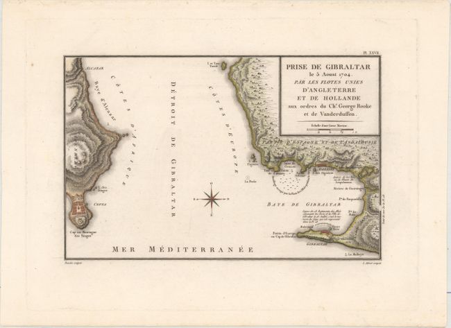
“Prise de Gibraltar le 5 Aoust 1704. Par les Flotes Unies d'Angleterre et de Hollande aux Ordres du Chr. George Rooke et de Vanderduffen”
Map Maker:
Nicolas-Marie Ozanne
This map depicts the August 1704 siege of Gibralta... (full text available to subscribers)
| Item Detail |
| |
| |
MapMaker: |
Nicolas-Marie Ozanne
|
|
| |
| |
Subject: |
Strait of Gibraltar |
|
| |
Period/Size: |
1797 / 8.1" x 12.6" (20.6 x 32.0 cm)
|
|
| |
Color: |
Colored
|
|
| |
Condition: |
(A) A dark impression on a clean, bright sheet. (condition help) |
|
| |
Source: |
Recueil de Combats et d'Expeditions Maritimes |
|
| |
References: |
|
|
| |
|
|
| Sales Information |
| |
| |
Price: |
|
|
| |
| |
Offered by: |
Old World Auctions |
|
| |
Catalog: |
Auction No. 174 - Antique Maps, Charts, Atlases & Globes (9472) |
|
| |
Lot/Item #: |
625 |
|
| |
| |
Date: |
09/2019
|
|
| |
| |
|
Antique Maps - Valuation and Pricing, Descriptions, Resources |
|
Home |
Information |
Search |
Register |
Contact Us |
Site Map
Americana Exchange, Inc. © 1999 - 2024 Americana Exchange, Inc.. All rights reserved.
OldMaps.com, the OldMaps.com logo and
AMPR are service marks or registered service marks of Americana Exchange, Inc..
|