Title:
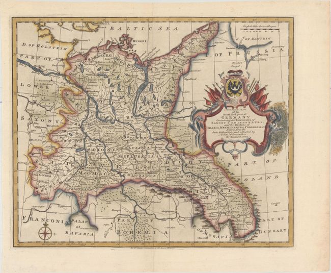
“A Correct Map of the North East Part of Germany. Containing the Electorates of Saxony & Brandenburg, and the Duchies of Silesia, Mecklenburg, Pomerania &c....”
Map Maker:
Emanuel Bowen
This detailed map of northeastern German extends a... (full text available to subscribers)
| Item Detail |
| |
| |
MapMaker: |
Emanuel Bowen
|
|
| |
| |
Subject: |
Northeastern Germany |
|
| |
Period/Size: |
1732 / 13.5" x 16.4" (34.3 x 41.7 cm)
|
|
| |
Color: |
Colored
|
|
| |
Condition: |
(A) A crisp impression on a bright sheet with a fleur-de-lis watermark and minor toning along the edges of the sheet. (condition help) |
|
| |
Source: |
Tindal's Continuation of Rapin's History of England |
|
| |
References: |
Shirley (BL Atlases) G.RAP-2a #9. |
|
| |
|
|
| Sales Information |
| |
| |
Price: |
|
|
| |
| |
Offered by: |
Old World Auctions |
|
| |
Catalog: |
Auction No. 174 - Antique Maps, Charts, Atlases & Globes (9472) |
|
| |
Lot/Item #: |
507 |
|
| |
| |
Date: |
09/2019
|
|
| |
| |
|
Antique Maps - Valuation and Pricing, Descriptions, Resources |
|
Home |
Information |
Search |
Register |
Contact Us |
Site Map
Americana Exchange, Inc. © 1999 - 2024 Americana Exchange, Inc.. All rights reserved.
OldMaps.com, the OldMaps.com logo and
AMPR are service marks or registered service marks of Americana Exchange, Inc..
|