| Item Detail |
| |
| |
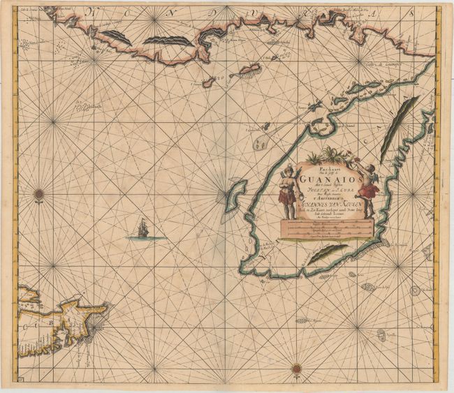
MapMaker: |
van Keulen [Family]
|
|
| |
| |
Subject: |
Mexico & Cuba |
|
| |
Period/Size: |
1695 / 20.0" x 22.6" (50.8 x 57.4 cm)
|
|
| |
Color: |
Colored
|
|
| |
Condition: |
(B+) A sharp impression on paper with a "CSH" watermark, light toning, and scattered foxing. There are some grayish shadows along the centerfold that are caused by our scanner and do not appear on the map itself. (condition help) |
|
| |
Source: |
Zee-Fakkel |
|
| |
References: |
|
|
| |
|
|
| Sales Information |
| |
| |
Price: |
|
|
| |
| |
Offered by: |
Old World Auctions |
|
| |
Catalog: |
Auction No. 174 - Antique Maps, Charts, Atlases & Globes (9472) |
|
| |
Lot/Item #: |
299 |
|
| |
| |
Date: |
09/2019
|
|
| |
| |
|