| Item Detail |
| |
| |
MapMaker: |
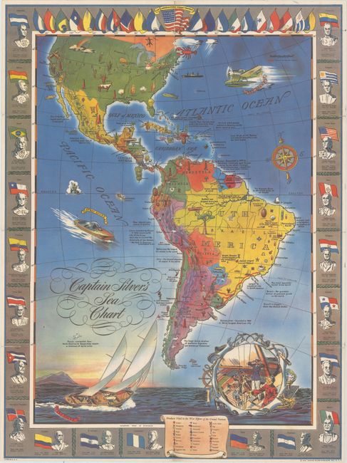
Infrequent Publ. - Broadsheet Maps
|
|
| |
| |
Subject: |
Western Hemisphere - America, World War II |
|
| |
Period/Size: |
1943 / 26.1" x 19.4" (66.3 x 49.3 cm)
|
|
| |
Color: |
Colored
|
|
| |
Condition: |
(B+) A colorful example, issued folding, with a 4" separation at top and a 1" separation at lower left that have been closed on verso with archival tape. Short splits at the fold junctions have resulted in some minor image loss. (condition help) |
|
| |
Source: |
|
|
| |
References: |
|
|
| |
|
|
| Sales Information |
| |
| |
Price: |
|
|
| |
| |
Offered by: |
Old World Auctions |
|
| |
Catalog: |
Auction No. 174 - Antique Maps, Charts, Atlases & Globes (9472) |
|
| |
Lot/Item #: |
87 |
|
| |
| |
Date: |
09/2019
|
|
| |
| |
|