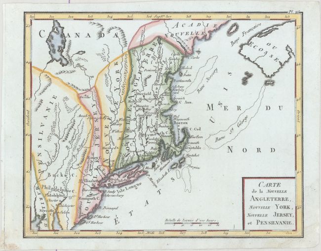
Title:
“Carte de la Nouvelle Angleterre, Nouvelle York, Nouvelle Jersey, et Pensilvanie”
Map Maker:
Citoyen Bertholon
This interesting map of New England exhibits some ... (full text available to subscribers)
| Item Detail |
| |
| |
MapMaker: |
Citoyen Bertholon
|
|
| |
| |
Subject: |
New England - United States |
|
| |
Period/Size: |
1799 / 7.0" x 8.7" (17.8 x 22.1 cm)
|
|
| |
Color: |
Colored
|
|
| |
Condition: |
(A) A crisp impression on watermarked paper with three tiny worm holes in the Atlantic only visible when held to light, two of which have been infilled on verso with archival materials. There is a hint of soiling in the bottom corners. (condition help) |
|
| |
Source: |
Atlas Moderne Portatif |
|
| |
References: |
cf. McCorkle #780.2. |
|
| |
|
|
| Sales Information |
| |
| |
Price: |
|
|
| |
| |
Offered by: |
Old World Auctions |
|
| |
Catalog: |
Auction No. 174 - Antique Maps, Charts, Atlases & Globes (9472) |
|
| |
Lot/Item #: |
145 |
|
| |
| |
Date: |
09/2019
|
|
| |
| |
|
Antique Maps - Valuation and Pricing, Descriptions, Resources |
|
Home |
Information |
Search |
Register |
Contact Us |
Site Map
Americana Exchange, Inc. © 1999 - 2024 Americana Exchange, Inc.. All rights reserved.
OldMaps.com, the OldMaps.com logo and
AMPR are service marks or registered service marks of Americana Exchange, Inc..
|