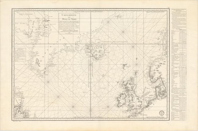
Title:
“Carte Reduite des Mers du Nord...”
Map Maker:
Jean Rene Antoine de Verdun de la Crenne
This sea chart of the northern Atlantic is centere... (full text available to subscribers)
| Item Detail |
| |
| |
MapMaker: |
Jean Rene Antoine de Verdun de la Crenne
|
|
| |
| |
Subject: |
North Atlantic |
|
| |
Period/Size: |
1776 / 22.0" x 30.9" (55.9 x 78.5 cm)
|
|
| |
Color: |
Black & White
|
|
| |
Condition: |
(B+) A fine impression on thick paper with a "Depot de la Marine" watermark. There is a 3.5" centerfold separation at center that has been closed on verso with archival tape and a light streak of soiling. (condition help) |
|
| |
Source: |
|
|
| |
References: |
|
|
| |
|
|
| Sales Information |
| |
| |
Price: |
|
|
| |
| |
Offered by: |
Old World Auctions |
|
| |
Catalog: |
Auction No. 174 - Antique Maps, Charts, Atlases & Globes (9472) |
|
| |
Lot/Item #: |
378 |
|
| |
| |
Date: |
09/2019
|
|
| |
| |
|
Antique Maps - Valuation and Pricing, Descriptions, Resources |
|
Home |
Information |
Search |
Register |
Contact Us |
Site Map
Americana Exchange, Inc. © 1999 - 2024 Americana Exchange, Inc.. All rights reserved.
OldMaps.com, the OldMaps.com logo and
AMPR are service marks or registered service marks of Americana Exchange, Inc..
|