| Item Detail |
| |
| |
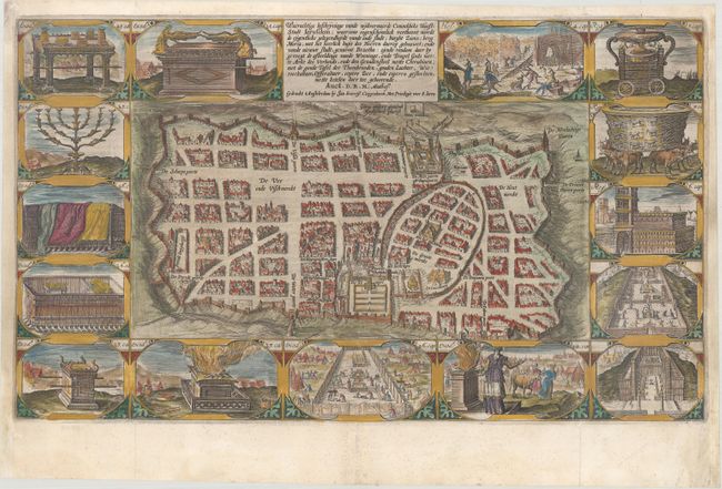
MapMaker: |
Plancius/Cloppenburg
|
|
| |
| |
Subject: |
Jerusalem, Holy Land |
|
| |
Period/Size: |
1643 / 11.4" x 19.6" (29.0 x 49.8 cm)
|
|
| |
Color: |
Colored
|
|
| |
Condition: |
(A) A nice impression, issued folding, with professional repairs to several short separations along the folds and marginal soiling. The right and left margins have been extended to accommodate framing. (condition help) |
|
| |
Source: |
|
|
| |
References: |
Laor #1101; Poortman & Augusteijn #79. |
|
| |
|
|
| Sales Information |
| |
| |
Price: |
|
|
| |
| |
Offered by: |
Old World Auctions |
|
| |
Catalog: |
Auction No. 174 - Antique Maps, Charts, Atlases & Globes (9472) |
|
| |
Lot/Item #: |
668 |
|
| |
| |
Date: |
09/2019
|
|
| |
| |
|