| Item Detail |
| |
| |
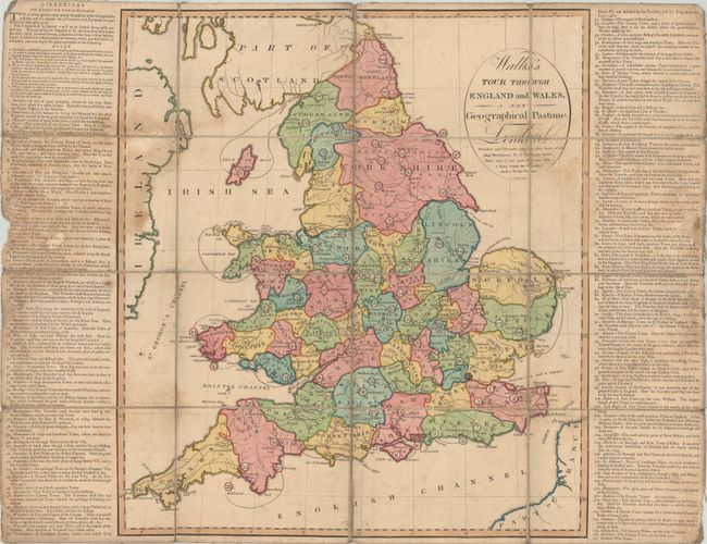
MapMaker: |
John Wallis
|
|
| |
| |
Subject: |
Cartographic Game, England & Wales |
|
| |
Period/Size: |
1794 / 19.8" x 17.6" (50.3 x 44.7 cm)
|
|
| |
Color: |
Colored
|
|
| |
Condition: |
(B) Issued folding with light toning, minor soiling, and a dampstain at left. There are some small chips to the text panels at left and right resulting in some minor loss. Dissected and backed on contemporary linen. No slipcase is present. (condition help) |
|
| |
Source: |
|
|
| |
References: |
|
|
| |
|
|
| Sales Information |
| |
| |
Price: |
|
|
| |
| |
Offered by: |
Old World Auctions |
|
| |
Catalog: |
Auction No. 177 - Antique Maps, Charts, Atlases & Globes (9498) |
|
| |
Lot/Item #: |
38 |
|
| |
| |
Date: |
04/2020
|
|
| |
| |
|