Title:
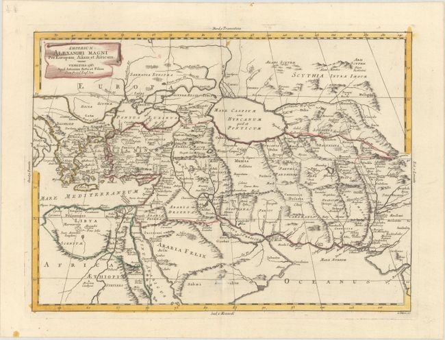
“Imperium Alexandri Magni per Europam, Asiam, et Africam”
Map Maker:
Antonio Zatta
This map covers the range of Alexander the Great's... (full text available to subscribers)
| Item Detail |
| |
| |
MapMaker: |
Antonio Zatta
|
|
| |
| |
Subject: |
Eastern Mediterranean & Middle East |
|
| |
Period/Size: |
1785 / 12.7" x 17.4" (32.3 x 44.2 cm)
|
|
| |
Color: |
Colored
|
|
| |
Condition: |
(A) A sharp impression with contemporary color on watermarked paper with a small abrasion on the centerfold at bottom. (condition help) |
|
| |
Source: |
Atlante Novissimo |
|
| |
References: |
Shirley (BL Atlases) T.ZAT-1a Vol. 4 #62. |
|
| |
|
|
| Sales Information |
| |
| |
Price: |
|
|
| |
| |
Offered by: |
Old World Auctions |
|
| |
Catalog: |
Auction No. 177 - Antique Maps, Charts, Atlases & Globes (9498) |
|
| |
Lot/Item #: |
580 |
|
| |
| |
Date: |
04/2020
|
|
| |
| |
|
Antique Maps - Valuation and Pricing, Descriptions, Resources |
|
Home |
Information |
Search |
Register |
Contact Us |
Site Map
Americana Exchange, Inc. © 1999 - 2024 Americana Exchange, Inc.. All rights reserved.
OldMaps.com, the OldMaps.com logo and
AMPR are service marks or registered service marks of Americana Exchange, Inc..
|