Title:
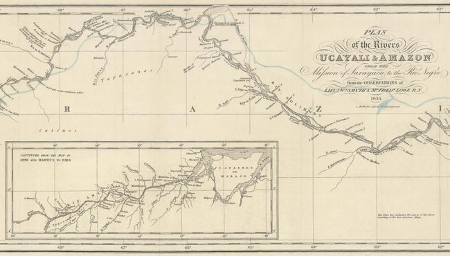
“Plan of the Rivers Ucayali & Amazon from the Mission of Sarayacu, to the Rio Negro, from the Observations of Lieut. Wm. Smyth & Mr. Fredk. Lowe, R.N.”
Map Maker:
John Murray
This incredibly detailed map of the Amazon River w... (full text available to subscribers)
| Item Detail |
| |
| |
MapMaker: |
John Murray
|
|
| |
| |
Subject: |
Amazon River |
|
| |
Period/Size: |
1836 / 7.7" x 32.2" (19.6 x 81.8 cm)
|
|
| |
Color: |
Colored
|
|
| |
Condition: |
(A) A crisp impression, issued folding on a bright sheet with contemporary outline color. Separations along the far left fold have been professionally repaired. (condition help) |
|
| |
Source: |
Journal of the Royal Geographical Society of London, Vol. 6 |
|
| |
References: |
|
|
| |
|
|
| Sales Information |
| |
| |
Price: |
|
|
| |
| |
Offered by: |
Old World Auctions |
|
| |
Catalog: |
Auction No. 177 - Antique Maps, Charts, Atlases & Globes (9498) |
|
| |
Lot/Item #: |
318 |
|
| |
| |
Date: |
04/2020
|
|
| |
| |
|
Antique Maps - Valuation and Pricing, Descriptions, Resources |
|
Home |
Information |
Search |
Register |
Contact Us |
Site Map
Americana Exchange, Inc. © 1999 - 2024 Americana Exchange, Inc.. All rights reserved.
OldMaps.com, the OldMaps.com logo and
AMPR are service marks or registered service marks of Americana Exchange, Inc..
|