Title:
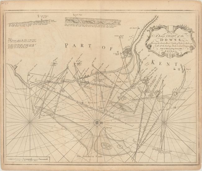
“A Large Chart of the Downs, Shewing the Sands, Shoals, Depths of Water & Anchorage, with All the Leading Marks to Avoid Dangers”
Map Maker:
Mount & Page
This handsome chart depicts the coastline of Kent ... (full text available to subscribers)
| Item Detail |
| |
| |
MapMaker: |
Mount & Page
|
|
| |
| |
Subject: |
Southeastern England |
|
| |
Period/Size: |
1780 / 18.6" x 23.5" (47.3 x 59.7 cm)
|
|
| |
Color: |
Black & White
|
|
| |
Condition: |
(B+) There is light offsetting with a short centerfold separation that just passes the neatline at bottom. (condition help) |
|
| |
Source: |
|
|
| |
References: |
|
|
| |
|
|
| Sales Information |
| |
| |
Price: |
|
|
| |
| |
Offered by: |
Old World Auctions |
|
| |
Catalog: |
Auction No. 177 - Antique Maps, Charts, Atlases & Globes (9498) |
|
| |
Lot/Item #: |
370 |
|
| |
| |
Date: |
04/2020
|
|
| |
| |
|
Antique Maps - Valuation and Pricing, Descriptions, Resources |
|
Home |
Information |
Search |
Register |
Contact Us |
Site Map
Americana Exchange, Inc. © 1999 - 2024 Americana Exchange, Inc.. All rights reserved.
OldMaps.com, the OldMaps.com logo and
AMPR are service marks or registered service marks of Americana Exchange, Inc..
|