Title:
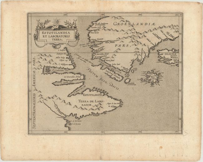
“Estotilandia et Laboratoris Terra”
Map Maker:
Cornelis Wytfliet
This fascinating map is from the first printed atl... (full text available to subscribers)
| Item Detail |
| |
| |
MapMaker: |
Cornelis Wytfliet
|
|
| |
| |
Subject: |
Eastern Canada & Greenland |
|
| |
Period/Size: |
1597 / 9.0" x 11.4" (22.9 x 29.0 cm)
|
|
| |
Color: |
Black & White
|
|
| |
Condition: |
(B+) A dark impression with a professionally repaired edge tear that extends 1" into the image at bottom. Two small wormholes adjacent to the upper centerfold have been infilled with a tiny amount of sea stippling in facsimile. (condition help) |
|
| |
Source: |
|
|
| |
References: |
Burden #101; Kershaw #40. |
|
| |
|
|
| Sales Information |
| |
| |
Price: |
|
|
| |
| |
Offered by: |
Old World Auctions |
|
| |
Catalog: |
Auction No. 177 - Antique Maps, Charts, Atlases & Globes (9498) |
|
| |
Lot/Item #: |
75 |
|
| |
| |
Date: |
04/2020
|
|
| |
| |
|
Antique Maps - Valuation and Pricing, Descriptions, Resources |
|
Home |
Information |
Search |
Register |
Contact Us |
Site Map
Americana Exchange, Inc. © 1999 - 2024 Americana Exchange, Inc.. All rights reserved.
OldMaps.com, the OldMaps.com logo and
AMPR are service marks or registered service marks of Americana Exchange, Inc..
|